Search
Search Results

- Alternative Title:
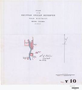
- Plan of the Skuppah Indian Reserves, Yale District. British Columbia.
- Subject:
- Indigenous peoples, Land cover, Land titles, Indian reservations, Land use, and Land titles--Maps
- Creator:
- Surveyor General of British Columbia
- Contributor:
- Jemmett, William Sugden, Captain, 1835-1922
- Language:
- eng
- Date Created:
- 1885 to 1887
- Rights Statement:
- No Copyright - Non-Commercial Use Only
- Resource Type:
- Still Image
- Identifier:
- LTSA Inventory No.: LTSA6177, Plan Barcode: Z0366536, LTSA SGD Microfilm Image Number: 106545, and Plan Number: 10TR-IR (original) (Yale)
- Extent:
- 1 sheet
- Geographic Coverage:
- British Columbia--Kamiak Creek, British Columbia--Fraser River, and British Columbia--Fraser River Valley
- Coordinates:
- 50.16644, -121.58589 and 50.18304, -121.58589
- Additional Physical Characteristics:
- Scale: 1 inch = 40 chains
- Physical Repository:
- Land Title and Survey Authority of British Columbia
- Collection:
- Land Title and Survey Authority of British Columbia: Indian Reserve Maps
- Provider:
- University of Victoria (B.C.). Library
- Genre:
- historical maps, maps (documents), and land surveys
- Technical Note:
- Cataloguing metadata: Provided by the LTSA and adapted by University of Victoria Libraries to their requirements.
- Alternative Title:
- Plan of the Skuppah Indian Reserves, Yale District. British Columbia.
- Subject:
- Land titles--Maps, Indigenous peoples, Indian reservations, Land titles, Land use, and Land cover
- Creator:
- Surveyor General of British Columbia
- Contributor:
- Jemmett, William Sugden, Captain, 1835-1922
- Language:
- eng
- Date Created:
- 1885 to 1887
- Rights Statement:
- No Copyright - Non-Commercial Use Only
- Resource Type:
- Still Image
- Identifier:
- LTSA Inventory No.: LTSA6177, LTSA SGD Microfilm Image Number: no number, Plan Number: 10TR-IR (tracing) (Yale), and Plan Barcode: Z0366537
- Extent:
- 1 sheet
- Geographic Coverage:
- British Columbia--Fraser River Valley, British Columbia--Fraser River, and British Columbia--Kamiak Creek
- Coordinates:
- 50.16644, -121.58589 and 50.18304, -121.58589
- Additional Physical Characteristics:
- Scale: 1 inch = 40 chains
- Physical Repository:
- Land Title and Survey Authority of British Columbia
- Collection:
- Land Title and Survey Authority of British Columbia: Indian Reserve Maps
- Provider:
- University of Victoria (B.C.). Library
- Genre:
- historical maps, land surveys, and maps (documents)
- Technical Note:
- Cataloguing metadata: Provided by the LTSA and adapted by University of Victoria Libraries to their requirements.