Search
Search Results
- Alternative Title:
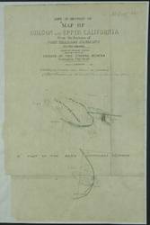
- Map of Oregon and Upper California From the Surveys of John Charles Fremont And other Authorities
- Subject:
- Boundaries and North American Boundary Commission
- Creator:
- Preuss, Charles, 1803-1854
- Contributor:
- Frémont, John Charles, 1813-1890
- Language:
- eng
- Date Created:
- 1854
- Rights Statement:
- In Copyright - Educational Use Permitted
- Resource Type:
- Still Image
- Extent:
- 1 sheet
- Geographic Coverage:
- United States, Canada, British Columbia, and British Columbia--Vancouver Island
- Coordinates:
- 53.99983, -125.0032, 39.76, -98.5, 49N/126W-122W, 60.10867, -113.64258, and 49.65064, -125.44939
- Chronological Coverage:
- 1848/1854
- Additional Physical Characteristics:
- 1.3,000000
- Physical Repository:
- National Archives (Great Britain)
- Collection:
- Early BC Maps Collection
- Provenance:
- National Archives of the UK
- Provider:
- University of Victoria (B.C.). Library
- Genre:
- maps (documents) and historical maps
- Date Digitized:
- 2010-04-22
- Transcript:
- "Exhibiting the Boundary Line between the possessions of Great Britain and the United States as therein laid down".
- Technical Note:
- 600 dpi jpg and Watermarks added to images by KM, JF, and CDW. Metadata by JTP May 3, 2010.