Search
Search Results

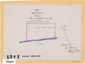
- Subject:
- Land titles--Maps, Land titles, Land use, Indian reservations, Land cover, and Indigenous peoples
- Creator:
- Surveyor General of British Columbia
- Contributor:
- MacLure, John Cunningham, 1831-1908
- Language:
- eng
- Date Created:
- 1864
- Rights Statement:
- No Copyright - Non-Commercial Use Only
- Resource Type:
- Still Image
- Identifier:
- LTSA SGD Microfilm Image Number: 106564 (1 of 2), Plan Number: 13TR-1A-IR (original), LTSA Inventory No.: LTSA6178, and Plan Barcode: Z0366571
- Extent:
- 1 sheet
- Geographic Coverage:
- British Columbia--Langley, British Columbia--Fraser River, and British Columbia--Metro Vancouver Regional District
- Coordinates:
- 49.08297, -122.58589
- Additional Physical Characteristics:
- Scale: 1 inch = 12 chains
- Physical Repository:
- Land Title and Survey Authority of British Columbia
- Collection:
- Land Title and Survey Authority of British Columbia: Indian Reserve Maps
- Provider:
- University of Victoria (B.C.). Library
- Genre:
- land surveys, historical maps, and maps (documents)
- Technical Note:
- Cataloguing metadata: Provided by the LTSA and adapted by University of Victoria Libraries to their requirements.
- Subject:
- Land cover, Indian reservations, Indigenous peoples, Land titles, Land titles--Maps, and Land use
- Creator:
- Surveyor General of British Columbia
- Contributor:
- MacLure, John Cunningham, 1831-1908
- Language:
- eng
- Date Created:
- 1864
- Rights Statement:
- No Copyright - Non-Commercial Use Only
- Resource Type:
- Still Image
- Identifier:
- LTSA Inventory No.: LTSA6178, LTSA SGD Microfilm Image Number: 106564 (2 of 2), Plan Number: 13TR-1A-IR (tracing), and Plan Barcode: Z0366572
- Extent:
- 1 sheet
- Geographic Coverage:
- British Columbia--Langley, British Columbia--Metro Vancouver Regional District, and British Columbia--Fraser River
- Coordinates:
- 49.08297, -122.58589
- Additional Physical Characteristics:
- Scale: 1 inch = 12 chains
- Physical Repository:
- Land Title and Survey Authority of British Columbia
- Collection:
- Land Title and Survey Authority of British Columbia: Indian Reserve Maps
- Provider:
- University of Victoria (B.C.). Library
- Genre:
- land surveys, maps (documents), and historical maps
- Technical Note:
- Cataloguing metadata: Provided by the LTSA and adapted by University of Victoria Libraries to their requirements.