Search
Search Results
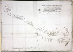
- Alternative Title:
- North America: Juan de Fuca Strait
- Creator:
- Haro, Gonzalo López de, -1823
- Contributor:
- Quimper Benítez del Pino, Manuel, 1740-1844
- Language:
- eng
- Date Created:
- 1790
- Rights Statement:
- In Copyright - Educational Use Permitted
- Resource Type:
- Still Image
- Identifier:
- Penfold Number: 497
- Extent:
- 1 sheet
- Geographic Coverage:
- Pacific Ocean--Nootka Sound, British Columbia--Vancouver Island, and Pacific Ocean--Strait of Juan de Fuca
- Coordinates:
- 50N-48N/122W-117W, 48.29674, -124.01225, 49.61132, -126.58271, and 49.65064, -125.44939
- Chronological Coverage:
- 1790
- Additional Physical Characteristics:
- 1:633,600
- Physical Repository:
- National Archives (Great Britain)
- Collection:
- Early BC Maps Collection
- Provenance:
- National Archives of the UK
- Provider:
- University of Victoria (B.C.). Library
- Genre:
- maps (documents) and historical maps
- Archival Item Identifier:
- National Archives Number: MPK1-203 (2)
- Date Digitized:
- 2010-04-12
- Technical Note:
- Watermarks added to images by KM, JF, and CDW. Metadata by JTP May 4, 2010. and 600 dpi jpg
- Alternative Title:
- Map of de Haro 1790
- Subject:
- San Juan Boundary Dispute (1846-1872)
- Creator:
- Haro, Gonzalo López de, -1823
- Contributor:
- Quimper Benítez del Pino, Manuel, 1740-1844
- Publisher:
- Harrison & Sons Lith.
- Language:
- eng and spa
- Date Created:
- 1790
- Rights Statement:
- In Copyright - Educational Use Permitted
- Resource Type:
- Still Image
- Identifier:
- Penfold Number: 500
- Extent:
- 1 sheet
- Geographic Coverage:
- Pacific Ocean--Haro Strait, North America--Northwest Coast of North America, and Pacific Ocean--Strait of Juan de Fuca
- Coordinates:
- 48.29674, -124.01225 and 48.54876, -123.21918
- Chronological Coverage:
- 1790/1873
- Physical Repository:
- National Archives (Great Britain)
- Collection:
- Early BC Maps Collection
- Provenance:
- National Archives of the UK
- Provider:
- University of Victoria (B.C.). Library
- Genre:
- maps (documents) and historical maps
- Archival Item Identifier:
- National Archives Number: FO925-1649 (a)
- Date Digitized:
- 2010-04-12
- Technical Note:
- 600 dpi jpg and Watermarks added to images by KM, JF, and CDW. Metadata by JTP May 6, 2010.

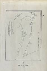
- Alternative Title:
- Plano del Estrecho de Fuca reconocido por el Alferez de Navio de la Rl. Armada Dn. Manuel Quimper
- Subject:
- San Juan Boundary Dispute (1846-1872)
- Creator:
- Haro, Gonzalo López de, -1823
- Contributor:
- Quimper Benítez del Pino, Manuel, 1740-1844
- Publisher:
- Harrison & Sons Lith.
- Language:
- spa and eng
- Date Created:
- 1790
- Rights Statement:
- In Copyright - Educational Use Permitted
- Resource Type:
- Still Image
- Identifier:
- Penfold Number: 500
- Extent:
- 1 sheet
- Geographic Coverage:
- British Columbia, Washington (State), British Columbia--Vancouver Island, and Pacific Ocean--Strait of Juan de Fuca
- Coordinates:
- 47.50012, -120.50147, 49.65064, -125.44939, 53.99983, -125.0032, and 48.29674, -124.01225
- Chronological Coverage:
- 1790/1873
- Physical Repository:
- National Archives (Great Britain)
- Collection:
- Early BC Maps Collection
- Provenance:
- National Archives of the UK
- Provider:
- University of Victoria (B.C.). Library
- Genre:
- maps (documents) and historical maps
- Archival Item Identifier:
- National Archives Number: FO925-1649 (j)
- Date Digitized:
- 2010-04-12
- Technical Note:
- 600 dpi jpg and Watermarks added to images by KM, JF, and CDW. Metadata by JTP May 10, 2010.