Search
Search Results
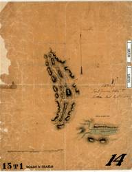
- Creator:
- Lempriere, Arthur Reid
- Language:
- eng
- Date Created:
- 1860
- Rights Statement:
- No Copyright - Non-Commercial Use Only
- Resource Type:
- Still Image
- Identifier:
- LSV Number: 15T1RT and 106730, 106731
- Extent:
- 1 sheet ; 42 x 51 cm
- Geographic Coverage:
- British Columbia--Boston Bar, British Columbia--Fraser River, British Columbia--Hope, British Columbia--Yale, and British Columbia--Spuzzum
- Coordinates:
- 49.6886, -121.41506, 49.11636, -123.18594, 49.56202, -121.42974, 49.87002, -121.44399, and 49.38299, -121.44144
- Additional Physical Characteristics:
- Scale: 5 Miles to One Inch
- Physical Repository:
- Land Title and Survey Authority of British Columbia
- Collection:
- Land Title and Survey Authority of British Columbia: Early British Columbia Maps
- Provenance:
- Surveyor General of BC, Legal Surveys Vault
- Provider:
- University of Victoria (B.C.). Library
- Genre:
- maps (documents) and historical maps
- Date Digitized:
- 2011-02-08
- Technical Note:
- Cataloguing metadata: Provided by the LTSA and adapted by the University of Victoria Libraries to their requirements.