Search Constraints
Filtering by:
Genre
maps (documents)
Remove constraint Genre: maps (documents)
Subject
Wildlife conservation
Remove constraint Subject: Wildlife conservation
1 - 5 of 5
Number of results to display per page
Search Results
-
 Alternative Title:Green World of Prince Alexander, TheSubject:Trees, Wildlife conservation, Recreation areas, Nature conservation, Plants, and ParksCreator:Contributor:Lievaart Vormgeving & Communicatie (Firm)Publisher:Centrum voor Natuur en Milieueducatie 'De Blijde Wei'Language:nldDate Created:2003Rights Statement:Resource Type:Still ImageIdentifier:Green Map System Number: EU7Extent:1 map : colour ; 49 x 69 cmGeographic Coverage:Netherlands--RotterdamCoordinates:51.9225, 4.47917Chronological Coverage:2003Collection:International Green MapsProvenance:Digital files provided by Green Map System, New York, NY.Provider:University of Victoria (B.C.). LibraryGenre:maps (documents)Date Digitized:2018-03-26Technical Note:200 dpi TIFF. Received in digital format. Metadata by PD and MT.Keyword in Context:Transcript available
I o.p f ~- • Parken, bijzondere bomen en tuinen • Fiets- en wandelroutes Gezien in Prins Alexander Ekster Lepelaar Krooneend Groene specht Putter Torenvalk Groot koolwitje Ringslang ------- \._ \ \ " -~· \ ---------- I I I ------/ --- \ ... -
 Alternative Title:Green Map of Pune: a historical citySubject:Parks, Wildlife conservation, Older people, Museums, Animals, Water harvesting, Community gardens, Farmers' markets, Natural monuments, Public art, Compost, and CultureCreator:Publisher:Anand UpalekarLanguage:engDate Created:2003Rights Statement:Resource Type:Still ImageIdentifier:Green Map System Number: AS15Extent:1 map : colour ; 54 x 41 cmGeographic Coverage:India--PuneCoordinates:18.51957, 73.85535Chronological Coverage:2003Collection:International Green MapsProvenance:Digital files provided by Green Map System, New York, NY.Provider:University of Victoria (B.C.). LibraryGenre:maps (documents)Date Digitized:2004-06-22Technical Note:300 dpi TIFF. Received in digital format. Metadata by PD and MT.
 -
 Subject:Trees, Sustainable buildings, Sewage disposal plants, Fair trade foods, Parks, Wetlands, Culture, Wildlife conservation, Museums, Community centers, Local transit, Open spaces, Environmental education, Renewable energy sources, Community gardens, Animals, Recycling (Waste, etc.), Public art, and Farmers' marketsCreator:Contributor:RMIT University. Centre for DesignPublisher:City of MelbourneLanguage:engDate Created:2001Rights Statement:Resource Type:Still ImageIdentifier:Green Map System Number: AU2Extent:1 map : colour ; 68 x 62 cmGeographic Coverage:Australia and Victoria--MelbourneCoordinates:-25, 135 and -37.814, 144.96332Chronological Coverage:2001Collection:International Green MapsProvenance:Digital files provided by Green Map System, New York, NY.Provider:University of Victoria (B.C.). LibraryGenre:maps (documents)Date Digitized:2007-06-19Technical Note:Adobe PDF. Received in digital format. Metadata by PD and MT.
 -
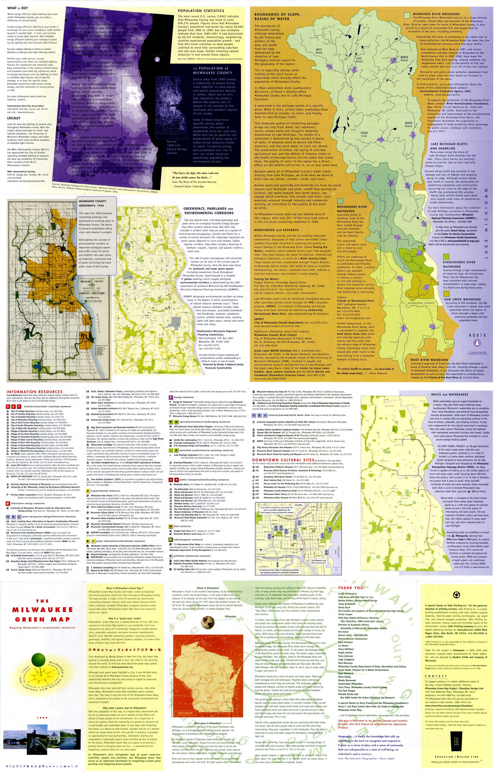
 Subject:Renewable energy sources, Watersheds, Culture, Thrift shops, Environmental education, Farmers' markets, Cycling, Natural areas, Wildlife conservation, Community gardens, Population--Statistics, Parks, Fair trade foods, Open spaces, Local transit, Animals, and Recycling (Waste, etc.)Creator:Contributor:Groshek, MatthewPublisher:Sells Printing Co.Language:engDate Created:1999Rights Statement:Resource Type:Still ImageIdentifier:Green Map System Number: US52Extent:1 map : colour ; 86 x 55 cmGeographic Coverage:Wisconsin--Milwaukee and United StatesCoordinates:39.76, -98.5 and 43.0389, -87.90647Chronological Coverage:1999Collection:International Green MapsProvenance:Digital files provided by Green Map System, New York, NY.Provider:University of Victoria (B.C.). LibraryGenre:maps (documents)Date Digitized:2007-06-11Technical Note:Adobe PDF. Received in digital format. Metadata by PD and MT.
 -
 Alternative Title:Kenoh Green Map, Tsubame-Sanjo, Nigata Pref. and Niigata prefecture Kenoh Green MapSubject:Neighborhoods, Museums, Outdoor recreation, Recreation areas, Plants, Trees, Wildlife conservation, and ParksCreator:Publisher:Tsubame-Sanjo Junior Chamber of CommerceLanguage:jpnDate Created:2003Rights Statement:Resource Type:TextIdentifier:Green Map System Number: JP32Extent:1 map : colour ; 58 x 41 cmGeographic Coverage:Japan--Tagami-machi, Japan--Teradomari-machi, Japan--Sanjō-shi, Japan--Niigata-ken, and Japan--Tsubame-shiCoordinates:37.61667, 138.95, 37.69828, 139.06947, 37.52343, 138.91748, 37.6645, 138.92518, and 37.58333, 138.73333Chronological Coverage:2003Collection:International Green MapsProvenance:Digital files provided by Green Map System, New York, NY.Provider:University of Victoria (B.C.). LibraryGenre:maps (documents)Date Digitized:2004-06-23Technical Note:300 dpi TIFF. Born digital resource. Metadata by PD and MT.