Search Constraints
Filtering by:
Genre
maps (documents)
Remove constraint Genre: maps (documents)
Year Range
2010
Remove constraint Year Range: 2010
1 - 3 of 3
Number of results to display per page
Search Results
-
 Alternative Title:Shelbourne Corridor Action Plan: map and vision survey resultsSubject:Neighborhoods, City planning, and Sustainable livingCreator:Contributor:Lydon, Maeve, Common Ground Community Mapping Project, Fingler, Theresa, and University of Victoria (B.C.). Department of GeographyPublisher:Green Map System (Firm)Language:engDate Created:2010Rights Statement:Resource Type:Still ImageExtent:1 map on 2 sheets : colourGeographic Coverage:British Columbia--Victoria and British Columbia--SaanichCoordinates:48.4359, -123.35155 and 48.54964, -123.36931Chronological Coverage:2010-01/2010-05Additional Physical Characteristics:Scale: ca. 1:2800Collection:Community Mapping ProjectProvenance:Digital files provided by University of Victoria Department of Geography.Provider:University of Victoria (B.C.). LibraryGenre:maps (documents)Date Digitized:2016-02-15Technical Note:400 dpi JPG. Born digital resource. Metadata by CDW and MT.
 -
 Subject:Sustainable living, Neighborhoods, and City planningCreator:Contributor:University of Victoria (B.C.). Department of Geography, Common Ground Community Mapping Project, Burnett, Charles, Maass, Amy, Jaswall, Harpreet, and Lydon, MaevePublisher:Green Map System (Firm)Language:engDate Created:2010Rights Statement:Resource Type:Still ImageExtent:1 map on 2 sheets : colourGeographic Coverage:British Columbia--Victoria and British Columbia--Victoria--South JubileeCoordinates:48.428471548089234, -123.33069155714776 and 48.4359, -123.35155Chronological Coverage:2010Collection:Community Mapping ProjectProvenance:Digital files provided by University of Victoria Department of Geography.Provider:University of Victoria (B.C.). LibraryGenre:road maps and maps (documents)Date Digitized:2016-02-15Technical Note:400 dpi JPG. Born digital resource. Metadata by CDW and MT.
 -
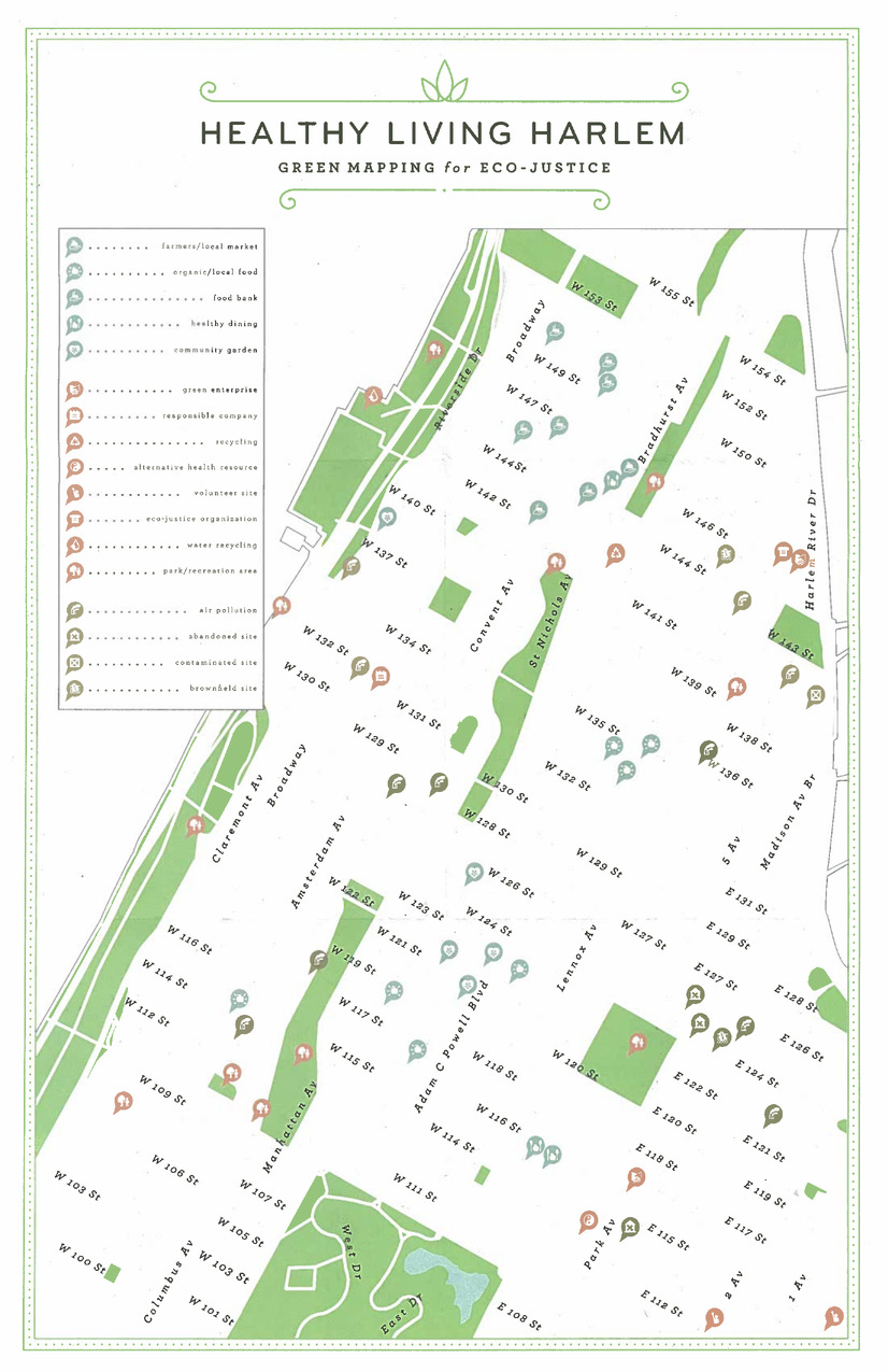 Subject:Food banks, Renewable energy sources, Farmers' markets, Air--Pollution, Environmental justice, Recycling (Waste, etc.), Parks, Water harvesting, Community gardens, and VoluntarismCreator:Publisher:Green Map SystemLanguage:engDate Created:2010Rights Statement:Resource Type:TextIdentifier:Green Map System Number: US64Extent:1 map : colour ; 27 x 43 cmGeographic Coverage:United States and New York (State)--New York--HarlemCoordinates:40.80788, -73.94542 and 39.76, -98.5Chronological Coverage:2010Collection:International Green MapsProvenance:Digital files provided by Green Map System, New York, NY.Provider:University of Victoria (B.C.). LibraryGenre:maps (documents)Date Digitized:2012-01-09Technical Note:Adobe PDF. Received in digital format. Metadata by PD and MT.