Search
Search Results
- Alternative Title:
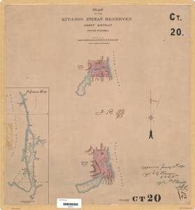
- Plan of the Kit-a-soo Indian Reserves Coast District British Columbia
- Subject:
- Land titles, Land cover, Indigenous peoples, Land use, Indian reservations, and Land titles--Maps
- Creator:
- Surveyor General of British Columbia
- Contributor:
- Devereux, Francis Algernon, 1867-1960
- Language:
- eng
- Date Created:
- 1892
- Rights Statement:
- No Copyright - Non-Commercial Use Only
- Resource Type:
- Still Image
- Identifier:
- LTSA SGD Microfilm Image Number: 106341, Plan Number: 20TR-IR (Coast), LTSA Inventory No.: LTSA6168, and Plan Barcode: Z0366309
- Extent:
- 1 sheet
- Geographic Coverage:
- British Columbia--Princess Royal Island, British Columbia--Graham Reach, Pacific Ocean--Klemtu Passage, and British Columbia--Kitimat-Stikine
- Coordinates:
- 55.33289, -129.00362, 52.53292, -128.58665, 52.96518, -128.80096, and 53.06118, -128.55489
- Additional Physical Characteristics:
- Scale: 1 inch = 40 chains
- Physical Repository:
- Land Title and Survey Authority of British Columbia
- Collection:
- Land Title and Survey Authority of British Columbia: Indian Reserve Maps
- Provider:
- University of Victoria (B.C.). Library
- Genre:
- maps (documents), land surveys, and historical maps
- Technical Note:
- Cataloguing metadata: Provided by the LTSA and adapted by University of Victoria Libraries to their requirements.