Search
Search Results
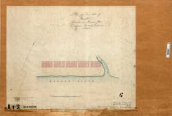
- Alternative Title:
- Plan of town site of Howell (Manson River)
- Subject:
- City planning--Maps and Cities and towns--Maps
- Creator:
- Launders, James Benjamin
- Language:
- eng
- Date Created:
- December 13, 1871
- Rights Statement:
- No Copyright - Non-Commercial Use Only
- Resource Type:
- Still Image
- Identifier:
- Historical Map Society of B.C. Map Number: 2241, LSV Number: 1T2TS, and 106061
- Extent:
- 1 map on 1 sheet ; 22 x 75 cm
- Geographic Coverage:
- British Columbia--Manson River
- Coordinates:
- 55.71654, -123.88647
- Additional Physical Characteristics:
- Scale: 100 Feet = 1 Inch
- Physical Repository:
- Land Title and Survey Authority of British Columbia
- Collection:
- Land Title and Survey Authority of British Columbia: Early British Columbia Maps
- Provenance:
- Surveyor General of BC, Legal Surveys Vault
- Provider:
- University of Victoria (B.C.). Library
- Genre:
- maps (documents), cadastral maps, and historical maps
- Date Digitized:
- 2013-04-10
- Technical Note:
- Cataloguing metadata: Provided by the LTSA and adapted by the University of Victoria Libraries to their requirements.