Search
Search Results
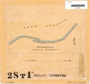
- Subject:
- Indigenous peoples, Land cover, Land titles--Maps, Land titles, Indian reservations, and Land use
- Creator:
- Surveyor General of British Columbia
- Language:
- eng
- Rights Statement:
- No Copyright - Non-Commercial Use Only
- Resource Type:
- Still Image
- Identifier:
- Plan Number: 28TR-1A-IR, Plan Barcode: Z0366600, LTSA SGD Microfilm Image Number: 106585, and LTSA Inventory No.: LTSA6178
- Extent:
- 1 sheet
- Geographic Coverage:
- British Columbia--Roberts Bank, British Columbia--Metro Vancouver Regional District, and British Columbia--Tsawwassen
- Coordinates:
- 49.06937, -123.22369 and 49.03296, -123.10263
- Additional Physical Characteristics:
- Scale: No scale
- Physical Repository:
- Land Title and Survey Authority of British Columbia
- Collection:
- Land Title and Survey Authority of British Columbia: Indian Reserve Maps
- Provider:
- University of Victoria (B.C.). Library
- Genre:
- land surveys, historical maps, and maps (documents)
- Technical Note:
- Cataloguing metadata: Provided by the LTSA and adapted by University of Victoria Libraries to their requirements.