Search
Search Results
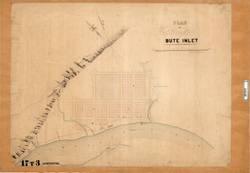
- Subject:
- Cities and towns--Maps and City planning--Maps
- Creator:
- Turnbull, James
- Language:
- eng
- Date Created:
- 1863
- Rights Statement:
- No Copyright - Non-Commercial Use Only
- Resource Type:
- Still Image
- Identifier:
- Historical Map Society of B.C. Map Number: 1837, 106130, and LSV Number: 17T3TS
- Extent:
- 1 sheet ; 60 x 85 cm
- Geographic Coverage:
- British Columbia--Waddington Harbor, British Columbia--Bute Inlet, and British Columbia--Homathko River
- Coordinates:
- 50.42208, -125.08553, 50.93204, -124.86099, and 50.90931, -124.83112
- Physical Repository:
- Land Title and Survey Authority of British Columbia
- Collection:
- Land Title and Survey Authority of British Columbia: Early British Columbia Maps
- Provenance:
- Surveyor General of BC, Legal Surveys Vault
- Provider:
- University of Victoria (B.C.). Library
- Genre:
- historical maps, maps (documents), cadastral maps, and relief maps
- Date Digitized:
- 2013-03-11
- Technical Note:
- Cataloguing metadata: Provided by the LTSA and adapted by the University of Victoria Libraries to their requirements.