Search
Search Results
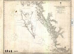
- Alternative Title:
- Vancouver Island to Cordova Bay
- Language:
- eng
- Date Created:
- June 25, 1856
- Rights Statement:
- No Copyright - Non-Commercial Use Only
- Resource Type:
- Still Image
- Identifier:
- Historical Map Society of B.C. Map Number: 1260, 107858, and LSV Number: 11T1CH
- Extent:
- 1 sheet ; 50 x 64 cm
- Geographic Coverage:
- British Columbia--Vancouver Island, British Columbia--Haida Gwaii, and Pacific Ocean--Cordova Bay
- Coordinates:
- 49.75152, -126.48958, 54.85083, -132.56639, and 52.34956, -131.43659
- Physical Repository:
- Land Title and Survey Authority of British Columbia
- Collection:
- Land Title and Survey Authority of British Columbia: Early British Columbia Maps
- Provenance:
- Surveyor General of BC, Legal Surveys Vault
- Provider:
- University of Victoria (B.C.). Library
- Genre:
- navigation charts, maps (documents), relief maps, and historical maps
- Date Digitized:
- 2011-11-25
- Technical Note:
- Cataloguing metadata: Provided by the LTSA and adapted by the University of Victoria Libraries to their requirements.