Search Constraints
Filtering by:
Geographic Coverage
United States
Remove constraint Geographic Coverage: United States
Subject
Recreation areas
Remove constraint Subject: Recreation areas
1 - 3 of 3
Number of results to display per page
Search Results
-
 Alternative Title:Philadelphus Green Map, Wakulla Green Map, Red Banks Green Map, Maxton Green Map, Pembroke Green Map, Alma Green Map, and Red Springs Green MapSubject:Recreation areas, Recycling (Waste, etc.), Farmers' markets, Parks, Community centers, Gardens, Cycling, Sewage, Plants, Water treatment plants--Waste disposal, and Environmental educationCreator:Contributor:Robeson County Green Map ProjectPublisher:Robeson County Green Map ProjectLanguage:engRights Statement:Resource Type:TextIdentifier:Green Map System Number: US85Extent:1 map : colour ; 35 x 21 cmGeographic Coverage:North Carolina--Pembroke, United States, North Carolina--Alma, North Carolina--Red Banks, North Carolina--Robeson County, North Carolina--Wakulla, North Carolina--Maxton, North Carolina--Philadelphus, and North Carolina--Red SpringsCoordinates:34.70294, -79.25087, 34.75905, -79.17142, 34.73516, -79.34893, 34.72377, -79.31254, 34.64009, -79.10353, 34.68016, -79.19504, 34.79266, -79.25504, 39.76, -98.5, and 34.81516, -79.18309Collection:International Green MapsProvenance:Digital files provided by Green Map System, New York, NY.Provider:University of Victoria (B.C.). LibraryGenre:maps (documents)Date Digitized:2004-05-06Technical Note:200 dpi TIFF. Received in digital format. Metadata by PD and MT.
 -
 Alternative Title:LoMap: explore downtown's environment as guided by youthSubject:Libraries, Public art, Farmers' markets, Community centers, Museums, Recycling (Waste, etc.), Air--Pollution, Local transit, Recreation centers, Thrift shops, Voluntarism, Culture, Animals, Parks, Recreation areas, Renewable energy sources, Community gardens, and PlantsCreator:Contributor:Kline, Diana Signe, Ferguson, Beth, and Brawer, Wendy E.Publisher:New York Recycled Paper Inc.Language:engDate Created:2000Rights Statement:Resource Type:Still ImageIdentifier:Green Map System Number: US3Extent:1 map : colour ; 94 x 30 cmGeographic Coverage:New York (State)--New York--Manhattan, New York (State), and United StatesCoordinates:40.78343, -73.96625, 40.71427, -74.00597, and 39.76, -98.5Chronological Coverage:2000Collection:International Green MapsProvenance:Digital files provided by Green Map System, New York, NY.Provider:University of Victoria (B.C.). LibraryGenre:maps (documents)Date Digitized:2007-06-11Technical Note:Adobe PDF. Received in digital format. Metadata by PD and MT.
 -
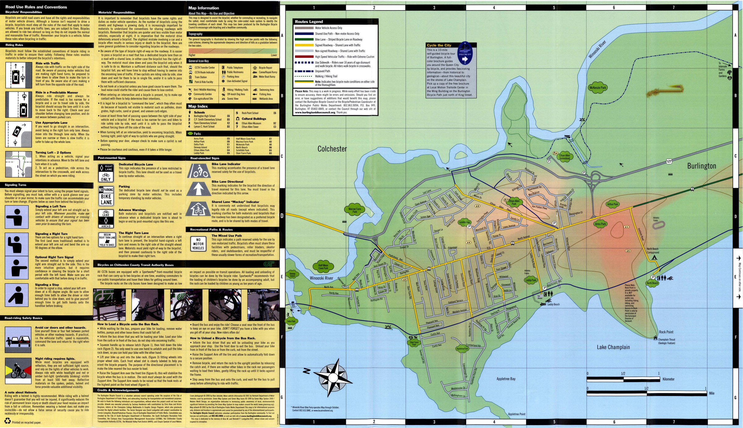
 Subject:Bicycle commuting, Local transit, Bicycle commuting--Safety measures, Cycling, Outdoor recreation, and Recreation areasCreator:Contributor:Lustgarten, DavidPublisher:Burlington Public WorksLanguage:engDate Created:2007Rights Statement:Resource Type:Still ImageIdentifier:Green Map System Number: US87Extent:1 map : colour ; 80 x 47 cmGeographic Coverage:United States and Vermont--BurlingtonCoordinates:44.47588, -73.21207 and 39.76, -98.5Chronological Coverage:2000/2007Collection:International Green MapsProvenance:Digital files provided by Green Map System, New York, NY.Provider:University of Victoria (B.C.). LibraryGenre:maps (documents)Date Digitized:2007-06-19Technical Note:Adobe PDF. Received in digital format. Metadata by PD and MT.