Search
Search Results
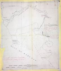
- Alternative Title:
- West coast of North America
- Subject:
- North American Boundary Commission
- Creator:
- Roberts, J.
- Contributor:
- Prevost, James Charles
- Language:
- eng
- Date Created:
- 1857
- Rights Statement:
- In Copyright - Educational Use Permitted
- Resource Type:
- Still Image
- Identifier:
- Penfold Number: 478
- Extent:
- 1 sheet
- Geographic Coverage:
- British Columbia--Fraser River, British Columbia, Pacific Ocean--Strait of Georgia, and Washington (State)
- Coordinates:
- 49.11636, -123.18594, 49 20'N-48 50'N/123 10'W-122 50'W, and 47.50012, -120.50147
- Chronological Coverage:
- 1857
- Additional Physical Characteristics:
- 1:95,040
- Physical Repository:
- National Archives (Great Britain)
- Collection:
- Early BC Maps Collection
- Provenance:
- National Archives of the UK
- Provider:
- University of Victoria (B.C.). Library
- Genre:
- maps (documents) and historical maps
- Archival Item Identifier:
- National Archives Number: MPK1-66 (1)
- Date Digitized:
- 2010-04-22
- Technical Note:
- 600 dpi jpg and Watermarks added to images by KM, JF, and CDW. Metadata by JTP May 3, 2010.