Search Constraints
Filtering by:
Collection
International Green Maps
Remove constraint Collection: International Green Maps
Subject
Nature conservation
Remove constraint Subject: Nature conservation
1 - 3 of 3
Number of results to display per page
Search Results
-
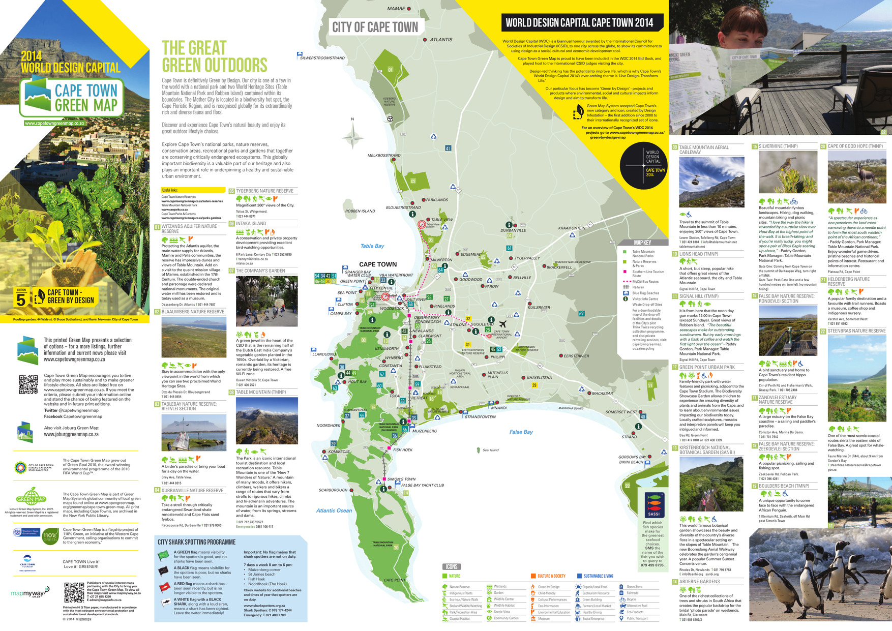
 Alternative Title:The great green outdoorsSubject:Recreation areas, Outdoor recreation, Beaches, Parks, and Nature conservationCreator:Publisher:A&C MapsLanguage:engDate Created:2014Rights Statement:Resource Type:Still ImageIdentifier:Green Map System Number: AF1Extent:1 map : colourEdition:5th editionGeographic Coverage:South Africa--Cape TownCoordinates:-33.92584, 18.42322Chronological Coverage:2014Collection:International Green MapsProvenance:Digital files provided by Green Map System, New York, NY.Provider:University of Victoria (B.C.). LibraryGenre:maps (documents)Date Digitized:2018-03-28Technical Note:Adobe PDF. Received in digital format. Metadata by PD and MT.Keyword in Context:Transcript available
TOKAI CAPE TOWN INTERNATIONAL AIRPORT KOMMETJIE ATLANTIS MAMRE ZEEKOEIVLEI ZANDVLEI RONDEVLEI Seal Island CHAPMAN’S PEAK FALSE BAY NATURE RESERVE Table Bay CAPE TOWN TABLE MOUNTAIN NATIONAL PARK (SILVERMINE) TABLE MOUNTAIN NATIONAL PARK TABLE MOUNTAIN NA... -
 Alternative Title:Green World of Prince Alexander, TheSubject:Trees, Wildlife conservation, Recreation areas, Nature conservation, Plants, and ParksCreator:Contributor:Lievaart Vormgeving & Communicatie (Firm)Publisher:Centrum voor Natuur en Milieueducatie 'De Blijde Wei'Language:nldDate Created:2003Rights Statement:Resource Type:Still ImageIdentifier:Green Map System Number: EU7Extent:1 map : colour ; 49 x 69 cmGeographic Coverage:Netherlands--RotterdamCoordinates:51.9225, 4.47917Chronological Coverage:2003Collection:International Green MapsProvenance:Digital files provided by Green Map System, New York, NY.Provider:University of Victoria (B.C.). LibraryGenre:maps (documents)Date Digitized:2018-03-26Technical Note:200 dpi TIFF. Received in digital format. Metadata by PD and MT.Keyword in Context:Transcript available
I o.p f ~- • Parken, bijzondere bomen en tuinen • Fiets- en wandelroutes Gezien in Prins Alexander Ekster Lepelaar Krooneend Groene specht Putter Torenvalk Groot koolwitje Ringslang ------- \._ \ \ " -~· \ ---------- I I I ------/ --- \ ... -
 Alternative Title:Discover the Nedbank Green Wine routeSubject:Vineyards, Nature conservation, Wine and wine making, and VintnersCreator:Publisher:A&C MapsLanguage:engDate Created:2015Rights Statement:Resource Type:Still ImageIdentifier:Green Map System Number: AF1Extent:1 map : colourEdition:6th editionGeographic Coverage:South Africa--Cape TownCoordinates:-33.92584, 18.42322Chronological Coverage:2015Collection:International Green MapsProvenance:Digital files provided by Green Map System, New York, NY.Provider:University of Victoria (B.C.). LibraryGenre:maps (documents)Date Digitized:2018-03-28Technical Note:Adobe PDF. Received in digital format. Metadata by PD and MT.Keyword in Context:Transcript available
TO CALEDON and GEORGE BOT RIVER STANFORD TO HERMANUS FALSE BAY TO MALMESBURY CAPE TOWN BELLVILLE WINELANDS GREEN POINT V&A WATERFRONT WOODSTOCK PAROW DURBANVILLE WELLINGTON STELLENBOSCH SOMERSET WEST CAMPS BAY HOUT BAY SEA POINT BLOUBERGSTRAND CLIFT...