Search
Search Results
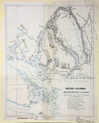
- Subject:
- Highway planning
- Creator:
- Armstrong, Robert
- Contributor:
- Oldham, William and Parsons, Robert Mann
- Publisher:
- Great Britain. Army. Royal Engineers. Columbia Detachment.
- Language:
- eng
- Date Created:
- 1861
- Rights Statement:
- In Copyright - Educational Use Permitted
- Resource Type:
- Still Image
- Identifier:
- Penfold Number: 399
- Extent:
- 1 sheet
- Geographic Coverage:
- British Columbia--Fraser River, British Columbia, British Columbia--Squamish-Lillooet, and British Columbia--New Westminster
- Coordinates:
- 50.6856, -121.942, 49.11636, -123.18594, 53.99983, -125.0032, 49.20678, -122.91092, and 50N-49N/124W-122W
- Chronological Coverage:
- 1861
- Additional Physical Characteristics:
- 1:633,600
- Physical Repository:
- National Archives (Great Britain)
- Collection:
- Early BC Maps Collection
- Provenance:
- National Archives of the UK
- Provider:
- University of Victoria (B.C.). Library
- Genre:
- maps (documents) and historical maps
- Archival Item Identifier:
- National Archives Number: CO700-BRITISH COLUMBIA11 (2)
- Date Digitized:
- 2010-04-12
- Technical Note:
- 600 dpi jpg and Watermarks added to images by KM, JF, and CDW. Metadata by JTP April 23, 2010.