Search
Search Constraints
Start Over Filtering by: Genre maps (documents) ✖ Remove constraint Genre: maps (documents)
Number of results to display per page
Search Results
-
- Alternative Title
- Jasper Park Alberta
- Subject
- National parks and reserves and Rivers
- Language
- eng
- Date created
- 1944? to 1946?
- Rights Statement
- In Copyright - Educational Use Permitted
- Resource Type
- Still Image
- Identifier
- COWAN_PH_295; From his publications Cowan_PN_893-895
- Extent
- 1 photograph : black and white
- Geographic Coverage
- Alberta--Jasper National Park and Alberta--Jasper
- Coordinates
- 52.98333, -118.10238
- Physical Repository
- University of Victoria (B.C.). Library
- Collection
- Ian McTaggart Cowan Collection
- Provider
- University of Victoria (B.C.). Library
- Sponsor
- Digitization undertaken with the support of Ann Schau.
- Genre
- photographs, black-and-white photographs, and maps (documents)
- Fonds Title
- Ian McTaggart Cowan Collection
- Fonds Identifier
- AR514
- Date Digitized
- 2012
- Technical Note
- Digitized by Briony Penn. Migration metadata by KD.
-
- Alternative Title
- Winter distribution of wolves in Banff Park
- Subject
- Wolves--Ecology, National parks and reserves, Winter, Mammals, Wolves--Geographical distribution, Rivers, Wolves, and Animal migration--Climatic factors
- Contributor
- McTaggart-Cowan, Ian, 1910-2010 and Reliance Engravers Limited
- Language
- eng
- Date created
- 1944? to 1946?
- Rights Statement
- In Copyright - Educational Use Permitted
- Resource Type
- Still Image
- Identifier
- COWAN_PH_293; From his publications Cowan_PN_893-895
- Extent
- 1 photograph : black and white
- Geographic Coverage
- Alberta--Banff National Park
- Coordinates
- 51.6, -116.0522
- Additional Physical Characteristics
- With note on right top corner: Cowan C.J.R. D.25 Fig. 3 93178 4 in.
- Physical Repository
- University of Victoria (B.C.). Library
- Collection
- Ian McTaggart Cowan Collection
- Provider
- University of Victoria (B.C.). Library
- Sponsor
- Digitization undertaken with the support of Ann Schau.
- Genre
- black-and-white photographs, photographs, and maps (documents)
- Fonds Title
- Ian McTaggart Cowan Collection
- Fonds Identifier
- AR514
- Date Digitized
- 2012
- Technical Note
- Digitized by Briony Penn. Migration metadata by KD.
-
- Alternative Title
- Map-winter range of wolves in Jasper Park
- Subject
- Wolves, Winter, National parks and reserves, Rivers, Wolves--Ecology, Wolves--Geographical distribution, Mammals, and Animal migration--Climatic factors
- Contributor
- McTaggart-Cowan, Ian, 1910-2010
- Language
- eng
- Date created
- 1944? to 1946?
- Rights Statement
- In Copyright - Educational Use Permitted
- Resource Type
- Still Image
- Identifier
- COWAN_PH_294; From his publications Cowan_PN_893-895
- Extent
- 1 photograph : black and white
- Geographic Coverage
- Alberta--Jasper and Alberta--Jasper National Park
- Coordinates
- 52.98333, -118.10238
- Additional Physical Characteristics
- With note on the bottom: 4 3/4 in. 93178 Cowan
- Physical Repository
- University of Victoria (B.C.). Library
- Collection
- Ian McTaggart Cowan Collection
- Provider
- University of Victoria (B.C.). Library
- Sponsor
- Digitization undertaken with the support of Ann Schau.
- Genre
- maps (documents), photographs, and black-and-white photographs
- Fonds Title
- Ian McTaggart Cowan Collection
- Fonds Identifier
- AR514
- Date Digitized
- 2012
- Technical Note
- Digitized by Briony Penn. Migration metadata by KD.
-
- Subject
- Indian reservations, Land titles, Indigenous peoples, Land cover, Land titles--Maps, and Land use
- Creator
- Surveyor General of British Columbia
- Language
- eng
- Rights Statement
- No Copyright - Non-Commercial Use Only
- Resource Type
- Still Image
- Identifier
- Plan Number: 22TR-IR (photograph) (Vancouver Island), LTSA SGD Microfilm Image Number: no number, Plan Barcode: Z0366485, and LTSA Inventory No.: LTSA6175
- Extent
- 1 sheet
- Geographic Coverage
- Pacific Ocean--Numukamis Bay, British Columbia--Alberni-Clayoquot, British Columbia--Carnation Creek, and British Columbia--Sarita River
- Coordinates
- 48.9058, -125.02948, 48.89802, -125.00193, 48.9141, -125.00287, and 48.89961, -125.00279
- Additional Physical Characteristics
- Scale: 1 inch = 20 chains
- Physical Repository
- Land Title and Survey Authority of British Columbia
- Collection
- Land Title and Survey Authority of British Columbia: Indian Reserve Maps
- Provider
- University of Victoria (B.C.). Library
- Genre
- land surveys, maps (documents), and historical maps
- Technical Note
- Cataloguing metadata: Provided by the LTSA and adapted by University of Victoria Libraries to their requirements.
-
- Subject
- Bridges--Design and construction and Bridges
- Language
- eng
- Rights Statement
- No Copyright - Contractual restrictions
- Resource Type
- Still Image
- Identifier
- G1/258p
- Extent
- 1 sheet
- Geographic Coverage
- British Columbia--Langford
- Coordinates
- 48.44963, -123.50261
- Physical Repository
- Hudson's Bay Company. Archives
- Collection
- Early B.C. Maps from the Hudson's Bay Company Archives
- Provider
- University of Victoria (B.C.). Library
- Genre
- maps (documents) and historical maps
- Date Digitized
- 2013-05-10
-
British Columbia Historical Maps
User Collection 6Collections887Works
- Subject
- Local History
- Location
- British Columbia, British Columbia, Canada
- Resource Type
- Collection
- Genre
- historical maps and maps (documents)
-
Community Mapping Project
User Collection 1Collections14Works
- Description:
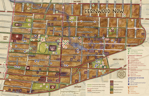
- This collection consists of digital versions of several print community maps produced through a collaborative process between various community groups and the Common Ground Community Mapping Project and later with the Community Mapping Collaboratory (CMC) at the...
- Subject
- Local History
- Location
- Victoria, British Columbia, Canada
- Resource Type
- Collection
- Genre
- maps (documents)
-
- Language
- eng
- Rights Statement
- No Copyright - Contractual restrictions
- Resource Type
- Still Image
- Identifier
- G1/143
- Extent
- 1 sheet
- Geographic Coverage
- British Columbia--Victoria Metropolitan Area
- Coordinates
- 48.4359, -123.35155
- Physical Repository
- Hudson's Bay Company. Archives
- Collection
- Early B.C. Maps from the Hudson's Bay Company Archives
- Provider
- University of Victoria (B.C.). Library
- Genre
- maps (documents) and historical maps
- Date Digitized
- 2013-05-10
-
Early British Columbia Maps
User Collection 1Collections248Works
- Description:
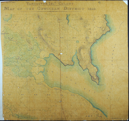
- These maps, from the National Archives of the UK, primarily span the dates 1846-1876 and show the development of the territory from the two founding colonies until after the Province joined confederation. A few earlier maps were collected by the Colonial Office in...
- Subject
- Local History
- Location
- British Columbia, British Columbia, Canada
- Resource Type
- Collection
- Genre
- maps (documents) and historical maps
-
- Subject
- Land use and Land cover
- Language
- eng
- Rights Statement
- Copyright Not Evaluated
- Resource Type
- Still Image
- Extent
- 1 sheet ; 77 x 90 cm
- Geographic Coverage
- British Columbia--Esquimalt
- Coordinates
- 48.43569, -123.41174
- Additional Physical Characteristics
- Scale: 20 chains = 1 inch. Photocopy.
- Collection
- British Columbia Historical Maps
- Provider
- University of Victoria (B.C.). Library
- Genre
- historical maps and maps (documents)
- Date Digitized
- 2024-03
- Technical Note
- Scanned on Betterlight/TTI (1/15; 303; copy4 tone; camera height 1000) by PD. Metadata by KD.
